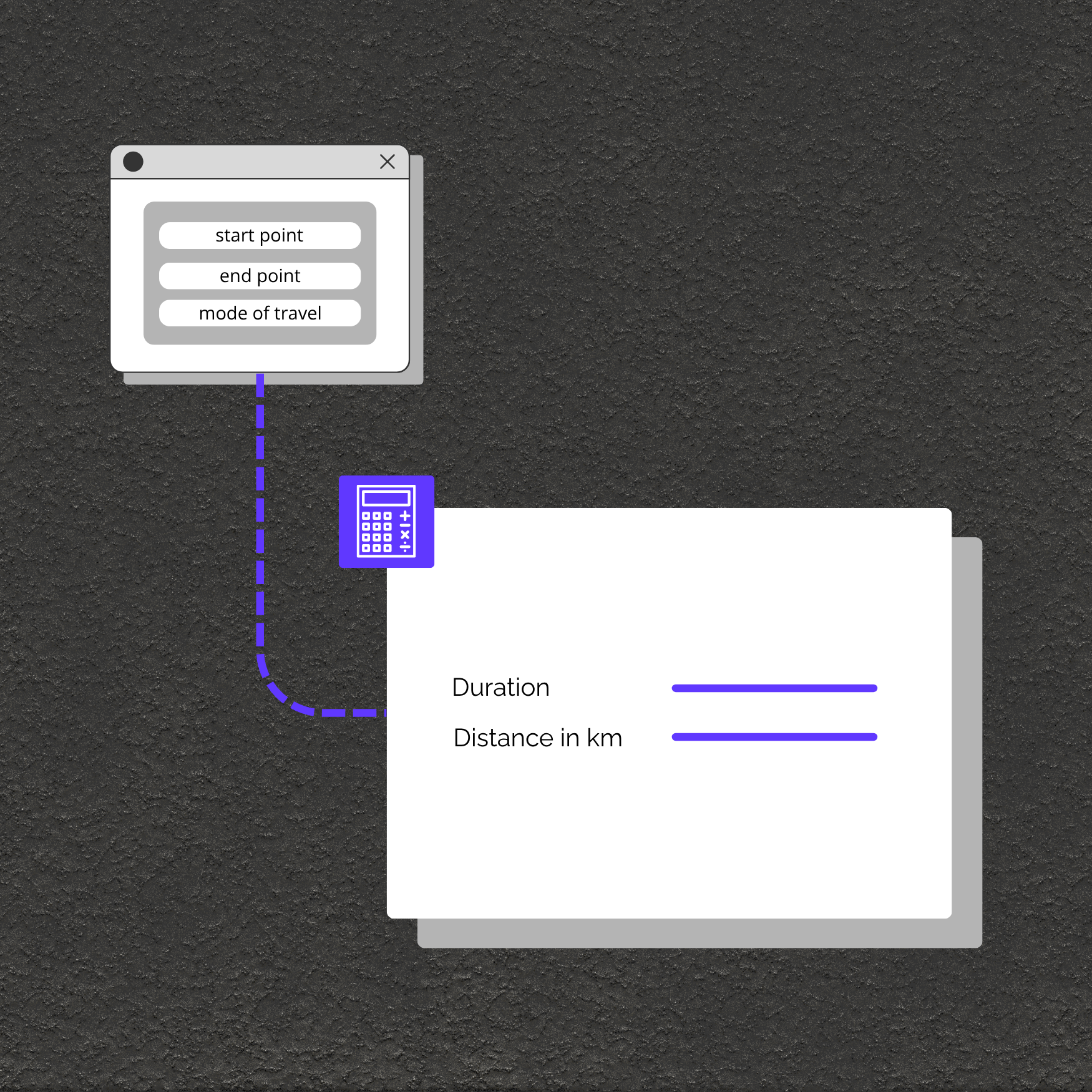
Geodistance Calculation

By 0CodeKit
Type
Calculate
Credits
5
Platform

Make

,

Zapier

,

N8N

,

API

,

Use the Geodistance Tool Endpoint in Make, Zapier & n8n

Our Geodistance Tool is designed to provide accurate distance and travel duration information between two locations for different modes of transportation. This is particularly useful for applications that need to calculate travel times for different travel modes, such as walking, driving, or cycling.

Benefits of the Geodistance Tool Endpoint

  • Accurate Distance Calculation: Obtain precise distances between two locations.
  • Travel Duration Estimates: Get detailed estimates of travel time.
  • Supports Multiple Modes: Calculate distances for walking, driving, cycling, and more.
  • Easy Integration: Simple API call for quick implementation into your projects.

What’s a Rich Text element?

The rich text element allows you to create and format headings, paragraphs, blockquotes, images, and video all in one place instead of having to add and format them individually. Just double-click and easily create content.

Static and dynamic content editing

A rich text element can be used with static or dynamic content. For static content, just drop it into any page and begin editing. For dynamic content, add a rich text field to any collection and then connect a rich text element to that field in the settings panel. Voila!

How to customize formatting for each rich text

Headings, paragraphs, blockquotes, figures, images, and figure captions can all be styled after a class is added to the rich text element using the "When inside of" nested selector system.

  • sdf;hgm
  • clkbm

Made Easier with 0CodeKit

The Geodistance Tool lets you calculate how far apart two places are and how long it takes to travel between them using different transportation modes. By providing the start and end points, along with the travel mode, you get back the distance in kilometers and the travel duration.

What’s a Rich Text element?

The rich text element allows you to create and format headings, paragraphs, blockquotes, images, and video all in one place instead of having to add and format them individually. Just double-click and easily create content.

Static and dynamic content editing

A rich text element can be used with static or dynamic content. For static content, just drop it into any page and begin editing. For dynamic content, add a rich text field to any collection and then connect a rich text element to that field in the settings panel. Voila!

How to customize formatting for each rich text

Headings, paragraphs, blockquotes, figures, images, and figure captions can all be styled after a class is added to the rich text element using the "When inside of" nested selector system.

  • sdf;hgm
  • clkbm
Use the Geodistance Tool Endpoint in Make, Zapier & n8n

Everything you need to
extend No Code

Free
$0
USD
Free Forever
25 App Credits per Month
Get Started
Starter
$7
USD
Per Month - Billed Annually
5.000 App Credits per Month
Get Started
Professional
$19
USD
Per Month - Billed Annually
25.000 App Credits per Month
Get Started
Company
$99
USD
Per Month - Billed Annually
125.000 App Credits per Month
Get Started
Free
$0
USD
Free Forever
25 App Credits per Month
Get Started
Starter
$10
USD
Per Month, Billed Annually or $10 USD Month-to-Month
5.000 App Credits per Month
Get Started
Professional
$25
USD
Per Month, Billed Annually or $25 USD Month-to-Month
25.000 App Credits per Month
Get Started
Company
$129
USD
Per Month, Billed Annually or $129 USD Month-to-Month
125.000 App Credits per Month
Get Started

FAQ

  • How to
    1. Provide Start and End Points: You send a request with the names of the start and end locations.
    1. Specify Travel Mode: Indicate the mode of travel, such as walking, driving, or cycling.
    1. Receive Distance and Duration: The endpoint calculates and returns the distance in kilometers and the estimated travel duration in hours and minutes.
  • Learn How-To Start with 0-CodeKit
    • Travel Planning: Estimate travel times for trip planning using different modes of transportation.
    • Fitness Apps: Calculate walking or cycling distances and times for users.
    • Logistics: Plan routes and schedules for deliveries or services.
    • Event Planning: Determine distances and travel times between event locations.
  • Summary

    The Geodistance Tool endpoint is a valuable resource for calculating distances and travel durations between two locations for various transportation modes. By supporting multiple travel modes and providing detailed results, it can be easily integrated into a wide range of applications, from travel planning to logistics. With a simple API call, you can obtain accurate and reliable distance and time estimates.

  • API Documentation

Screenshot

No items found.